Developed a geospatial workflow to support classification of residential properties across Salt Lake County by improving parcel, address, and building footprint data. The project focused on resolving inconsistencies in spatial datasets and generating missing building footprints using deep learning and multi source integration.
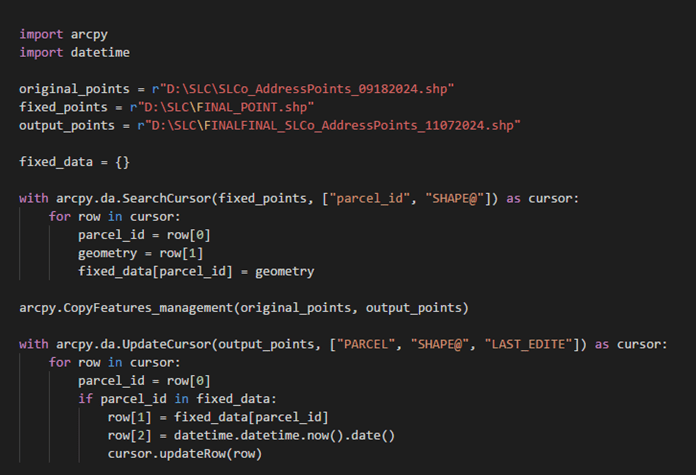
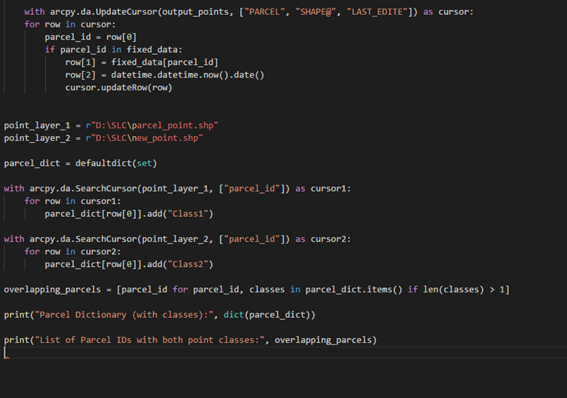
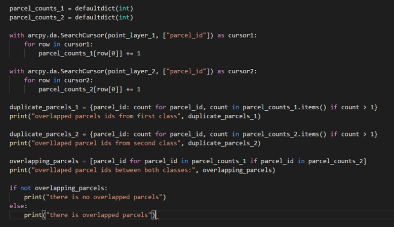
1. Parcel & Address Point Alignment
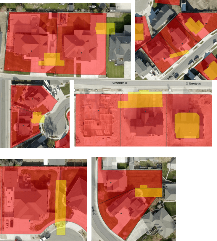
- Reconstructed parcel-level address data by aligning building geometry with parcel boundaries
- Developed a workflow to ensure one accurate address point per parcel
- Resolved inconsistencies caused by overlapping structures, multi-unit buildings, and outdated data
2. Building Footprint Generation
- Built a workflow to generate missing building footprints for 17,000+ parcels using deep learning
- Combined multiple datasets (deep learning outputs, Microsoft, OpenStreetMap) to improve coverage
- Achieved ~60% footprint coverage through data integration and quality control
3. Data Processing & Optimization
- Automated large-scale spatial data processing using ArcPy
- Reduced processing time by over 50% using parallel computing
- Designed scalable workflows for handling county-scale datasets
4. Data Integration & Application Support
- Integrated parcel, footprint, and address datasets for building-level analysis
- Improved data reliability for downstream modeling and applications
- Supported development of user-friendly GIS applications for non-technical users